Red Rock Loop Scenic Drive: Best Stops & Views in Sedona
One lazy Sunday we took a drive to Sedona just to explore Red Rock Loop Road. Since then we’ve been back numerous times. The Red Rock Loop is exactly what is sounds like.
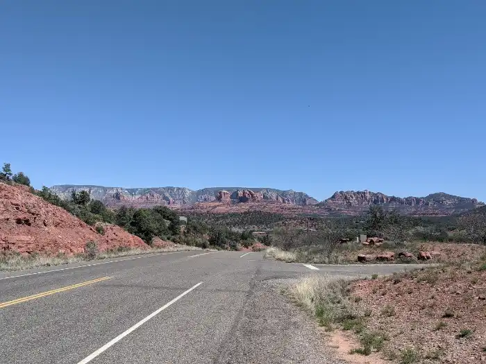
Just about eight miles long, it is a paved loop off of 89A in Sedona. So, you’re curious about the Red Rock Loop? Well, buckle up for a day trip, because we’re going to share all of our favorite stops.
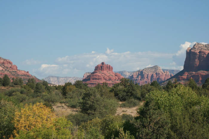
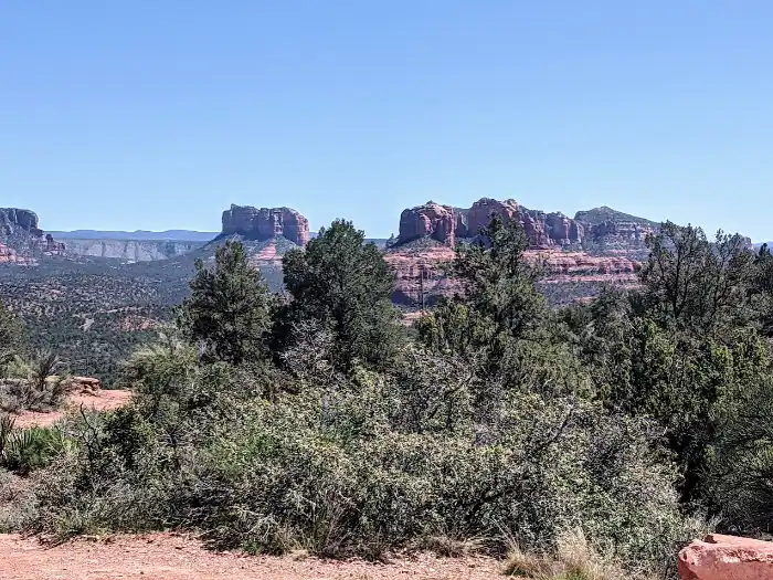
On the Red Rock Loop in Sedona you’ll wind through towering buttes with views of rugged canyons. You can find peaceful picnic spots, and trails that are perfect for stretching your legs without committing to a full-on hike.
This post may contain affiliate links. Please read our disclosure policy.
How to Get To Red Rock Loop in Sedona
From Phoenix
If you are driving from Phoenix take I-17 north to the Camp Verde 260 exit and make a left towards Sedona this will take you down State Route 179. At the “Y” roundabout take a left on 89A towards Cottonwood, from here it is about 13 miles on your left to the Red Rock Loop.
From Flagstaff
If you are driving from Flagstaff take I-17 south, exit on 89A and follow this scenic road for about 40 miles. It will wind through Oak Creek Canyon, uptown Sedona and towards west Sedona. Turn left on the Red Rock Loop.
Since it is a loop there are two entrances the upper and the lower loop. Coming from Phoenix we usually start from the upper loop. If you’re coming from Cottonwood you’ll probably turn at the lower loop.
Best Time to Visit
There are few places where I will say any season is gorgeous, but you’re in luck because there is no bad time of year to drive the Red Rock Loop Road.
If you visit in the spring you’ll get to see all of the pretty wildflowers, summer you can cool off in Oak Creek, fall you get to see the leaves turn hues of gold, orange and red, and the winter you may see a dusting of snow as a gorgeous contrast on the red rocks.
For the ultimate experience, aim for early morning or late afternoon. The play of light on the rocks during sunrise or sunset is especially lovely.
What to See on Red Rock Loop Road
You don’t have to hike miles to enjoy the beauty here. Along the way, here are a few of our favorite stops:
- Scenic vistas where you can pause and take in panoramic views.
- Hiking trails for all levels, perfect if you’re looking for something casual but still want to explore.
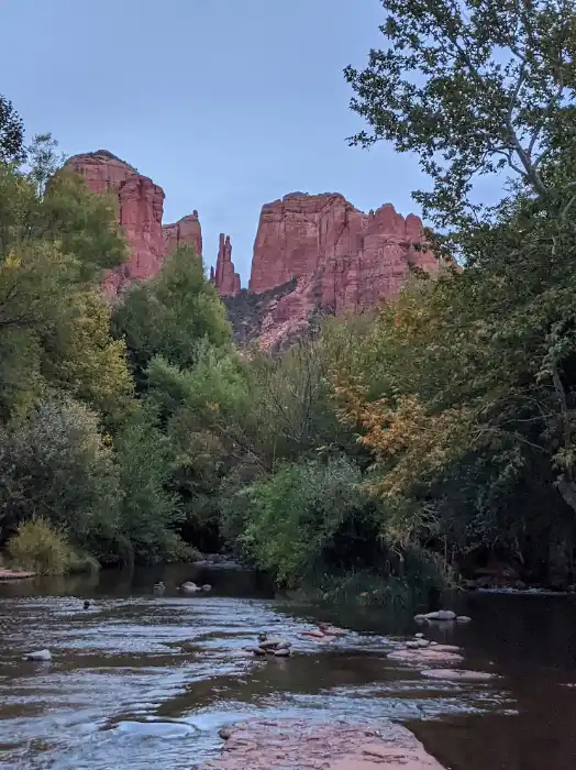
- Crescent Moon Ranch is a beautiful spot with creek access and views of Cathedral Rock.
- Red Rock State Park is a great stop for hikes, views of the mountains and a deeper look at the area’s ecology.
Upper Red Rock Loop Hiking Trailheads
Almost immediately when entering the Red Rock Loop there is a trailhead for Schuerman Mountain Trailhead. This trailhead will merge with the Vista trailhead and the Red Rock Loop trail.
If you want to do some hiking Pyramid Mountain Trailhead is .5 miles from Lover’s Knoll on your right.
This is also where the road branches off to Chavez Branch Road. If you turn down this road it leads you to Crescent Moon Ranch for more hiking trails.
Scenic Vistas
If you take Upper Red Rock Loop road the scenic vistas are easier to turn into. The first scenic overlook is on your left in .5 miles.
An additional .5 miles up the road you’ll find a popular scenic overlook referred to as Lover’s Knoll.
Crescent Moon Ranch
You can explore one of our favorite parks, Crescent Moon Ranch, just off of the Loop Road. Take Chavez Ranch Road to Red Rock Crossing Road and this will lead you to the park.
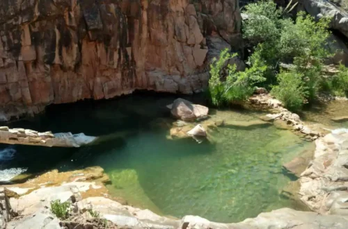
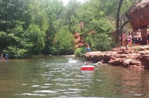
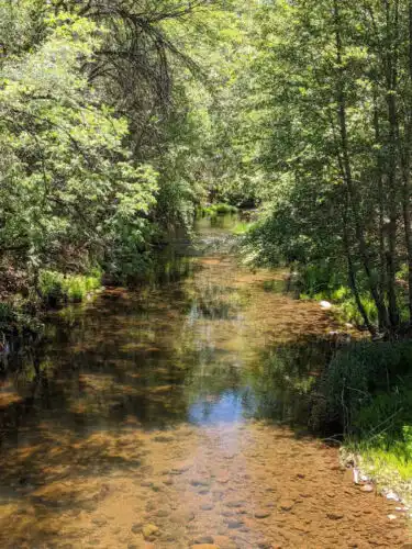
Looking to cool off in Oak Creek? You can at Crescent Moon Ranch, but you cannot at Red Rock State Park. At Crescent Moon Picnic Site you can see a historic waterwheel and take a short hike to see incredible views of Cathedral Rock.
Take a blanket and some food. Have a picnic lunch next to Oak Creek and soak in the amazing views.

Drive back to the Red Rock Loop and continue on your journey. You’ll wind around the buttes for three miles and then make a left to Red Rock State Park.
How to get to Crescent Moon Ranch
If you’re entering from the Upper Red Rock Loop Road go straight to Chavez Ranch Road and then turn right on Red Rock Crossing Road.
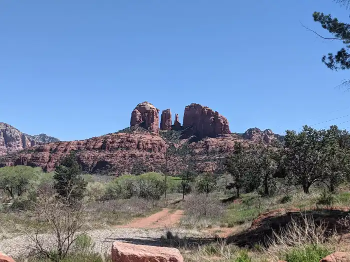
Cathedral Rock Scenic View
Near Jones Lane and Upper Red Rock Road
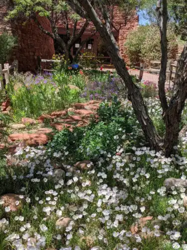
Red Rock State Park
We visited this park once years ago when the kids were younger. It has a nice long paved walking path they had fun running down. The next time I visited I went with just my daughter and there were only a few other people in the park. The visitor center has a pretty garden.
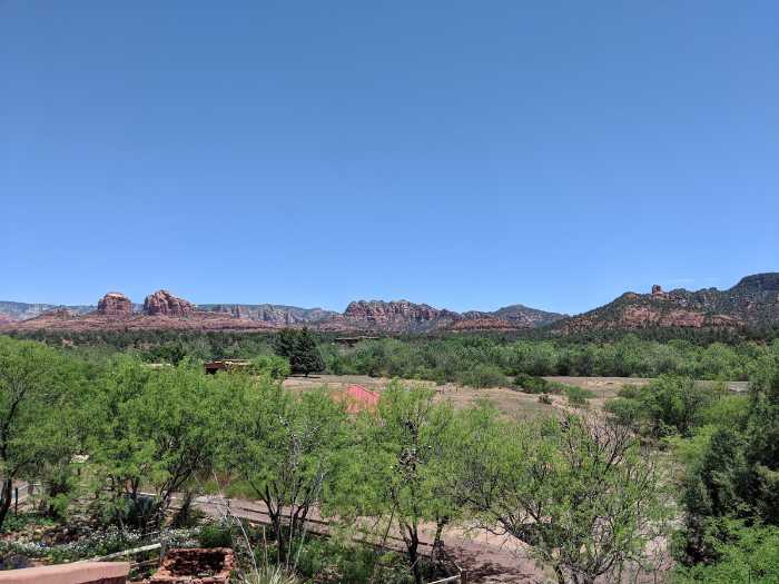
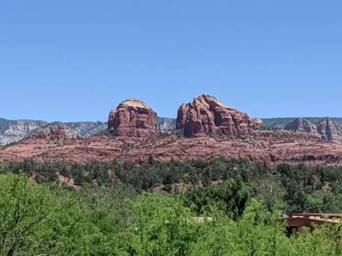
From the visitor center you have an expansive view of Red Rock State Park. You can see the red rock formations from left to right: Cathedral Rock, Seven Warriors, Napolean’s Tomb, and at the end Three Sisters.
The Bunkhouse Trail is the paved circular trail you can view from the visitor center. Several other trails intersect with this main trail. We walked the loop right to left, so the first trail we came to was the Smoke Trail that eventually leads to the Sentinel Trail along Oak Creek.
The State Park is a nature preserve and as such visitors are not allowed to wade or swim in Oak Creek. You can however hike along side it, listen to the sounds of the water and take in the views.
If you want to swim or wade in the water go to the Crescent Moon Picnic Site up the road.
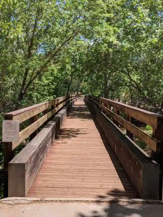
The Sentinel Trail leads to the Kisva Trail. If you turn left at the fork the trail will lead you to the East Gate Trail and the Kingfisher Bridge.
There are 15 trails that interconnect and wind through the park.
Lower Red Rock Loop
From the Red Rock State park if you continue back on Red Rock Loop Road to complete the drive, the next stop would be a just under two miles to the Cliffhanger trailhead.
A little over one mile ahead on your right is a Red Rock Loop hiking trailhead. This trailhead will connect with Schuerman Mountain Trailhead.
Nearby Attractions
Less than five miles from the Red Rock Loop is the Sedona Airport Scenic Lookout or Airport Mesa. This is a very popular overlook to watch the sunset. There are some great hikes in this area as well.
First time visitor? An essential guide to Sedona, Arizona for first time visitors
- Book a Flight to Sedona: To Sedona the closest airport is Flagstaff Pulliam and Sky Harbor in Phoenix.
- Rent a Car to Sedona: You can rent a car in Flagstaff or Phoenix and drive to Sedona. Alternatively you can leave the driving to someone else and take a bus tour from Phoenix to Sedona.
- Where to Stay in Sedona: Choose from hotels, motels, resorts, airbnb, vrbo, cabins, and camp sites in Sedona.
- Tours to Take in Sedona