Lake Life – Lake Pleasant Boating
Looking to cool off or soak up some sunshine, boating at Lake Pleasant is one of the best ways to spend a weekend in Arizona. Tucked into the desert hills of Peoria, this massive reservoir is just about an hour from downtown Phoenix , making it an easy drive for anyone craving open water and wide skies.
Lake Pleasant
Lake Pleasant is the second largest lake in the Phoenix area, and it earns that title with plenty of room for jet skis, sailboats, kayaks, motorized boats, or pontoons. Whether you’re into fishing at sunrise, tubing with the kids or paddling the day away, this is where everyone in the Valley comes to play when the temps rise.
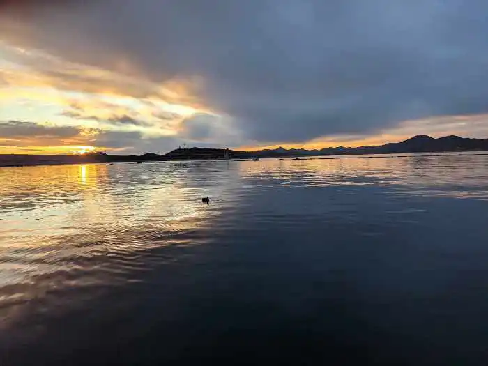
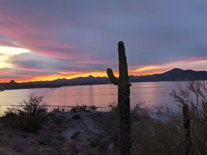
We love the water and spend many weekends boating at Lake Pleasant. It is our favorite lake in Arizona.
This post may contain affiliate links. Please read my disclosure policy.
Where is Lake Pleasant?
Lake Pleasant is just under an hour from Phoenix center. It is northwest from the city off of Carefree Highway and is part of the Lake Pleasant Regional Park.
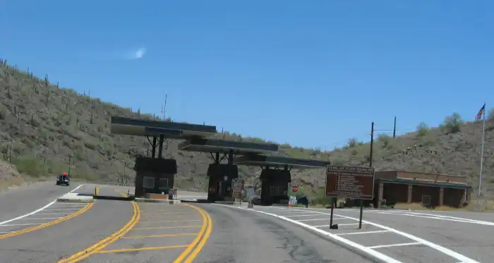
Lake Pleasant Entrances
There are three entrances to the Lake: two at Lake Pleasant Regional Park and another entrance at Pleasant Harbor Marina. Which one you decide to go to depends on what you would like to do at the lake.
Lake Pleasant Regional Park
Lake Pleasant Regional Park has a main park entrance and a north entrance. They are both located on the west side of the lake.
The main entrance will take you to the following:
- Campgrounds (main)
- 10-lane boat ramp (main)
- 4-lane boat ramp (north)
- Discovery Center (main)
- Hiking trails (main)
- Scorpion Bay Marina
Pleasant Harbor Marina Entrance
In addition, you can access the lake from the Pleasant Harbor Marina. If you’re coming from Phoenix this entrance is closer than the main entrance. From here you can access:
- 2 public boat Ramps
- RV Resort
- Dillon’s Bayou Restaurant
So you have several choices of where to enter. There is an entrance fee at both.
How to Get to the Main Regional Park Entrance
- From Phoenix take I-17 north and make a left or go west at the Carefree Highway, Highway 74 exit. Follow Carefree Highway for around 15 miles and take a right on North Castle Hot Springs Road.
- The main entrance to the park will be 2.5 miles from this point. Take a right on Lake Pleasant access road. To get to the 10-lane boat ramp and camping sites take your first right on South Park Road.
- After the booth take your first right you will follow this road until you see the 10 lane boat ramp to your left. There is plenty of parking for vehicles and trailers.
- On holidays it is not unusual for the park to reach max capacity.
How to Get to the Regional Park North Entrance
- A few miles north of the main entrance there is a second entrance to the park.
- Follow North Castle Hot Springs road for three miles past the main entrance.
- Turn right on Castle Creek Drive. You’ll find the smaller 4-lane boat ramp and a nice spot to pitch a tent for the day to go swimming. This area is nice to launch a boat from because it is less crowded.
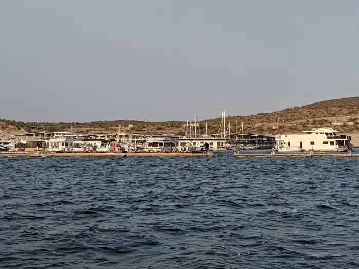
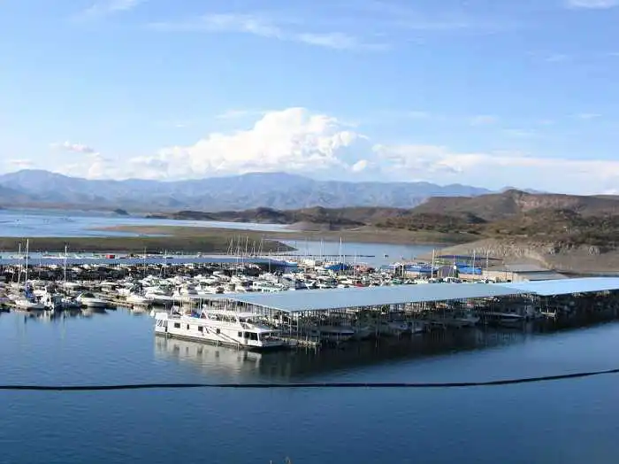
Lake Pleasant Marinas
There are two marinas at Lake Pleasant:
- Scorpion Bay
- Pleasant Harbor Marina
Scorpion Bay can be accessed via the main entrance of the park and the Pleasant Harbor Marina is right before the main entrance of the park off of 87th Avenue.
How to Get to Scorpion Bay Marina
- Follow the directions to get to the Park’s main entrance.
- From Phoenix take I-17 north and make a left or go west at the Carefree Highway, Highway 74 exit. Follow Carefree Highway for around 15 miles and take a right on North Castle Hot Springs Road.
- The main entrance to the park will be 2.5 miles from this point. Take the second road on your right, Peninsula Blvd and this will take you to Scorpion Bay Marina.
How to Get to Pleasant Harbor Marina
- If you are driving from Phoenix, you’ll notice the signs for Pleasant Harbor Marina several miles before the Lake Pleasant Regional Park main entrance.
- The marina is located right off of Carefree Highway at 8708 W. Harbor Blvd. Coming from Phoenix on Carefree Highway you would make a right turn onto 87th Avenue, which is at the bottom of the hill.
Boat Ramps at Pleasant Harbor
Pleasant Harbor Marina has two public 4-lane boat ramps and one private boat ramp.
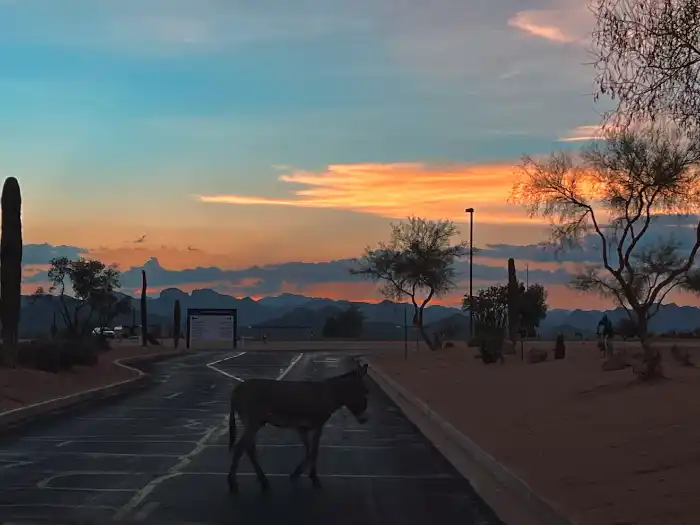
One public ramp is located on the north side and one on the south side. The north boat ramp has some very pretty views. The south ramp is only open during high water level times.
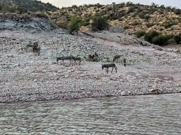
Both the south and the north side are nice to launch a boat from as we experienced less current when loading and unloading in comparison to the 10-lane ramp. Wild burros could be seen from this area.
Where to Park at Pleasant Harbor Marina
There is limited parking by the actual public boat ramps. There is a larger parking area when you first enter the marina.
If you enter from the Pleasant Harbor Marina and park in the parking lot to your right you will find a shaded structure that you can wait for a shuttle (golf cart) to take you directly to the marina. You do not need to be a member to ride the shuttle. At the marina you can rent jet skis and paddle boards or eat at the restaurant.
They also offer boat storage, restrooms, boat fueling, scuba diving, shaded picnic tables, and an RV Resort.
What Can You do at Lake Pleasant
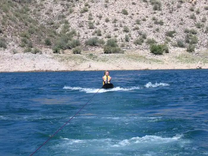
With 10,000 acres of water, there is plenty of space for fishing in the many coves or having fun water skiing, tubing, jet skiing, knee boarding, or just enjoy a beautiful day on the lake.
Both marinas have general stores and restaurants. Dillons Bayou Restaurant, at Pleasant Harbor Marina, is the larger of the two restaurants and often has live bands. Scorpion Bay Grill offers burgers, salads and drinks.
You can rent boats, jet skis, kayaks, and paddleboards at the marinas and have fun at the inflatable waterparks.
- Boat
- RV Resort (Pleasant Harbor Marina)
- Fish
- Camp, Boat-in Camping available at Park
- Hike
- Water Sports
- Jet Ski
- H2 Woah Water Slide (Pleasant Harbor Marina)
- Woah Island (Pleasant Harbor Marina)
- Paqua Park (Scorpion Bay)
- Floating Cabin Rentals (Scorpion Bay)
Lake Pleasant Boating & Rentals
Boating at Lake Pleasant is so fun. There are many coves to explore. You can rent a slip at Pleasant Harbor Marina or Scorpion Bay. Last I heard the waiting list was about three years. Alternatively the marinas offer offer dry storage or you can launch your boat at one of the six boat ramps.
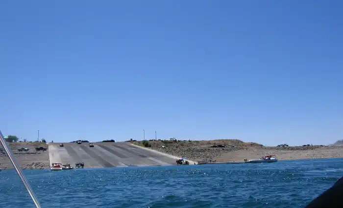
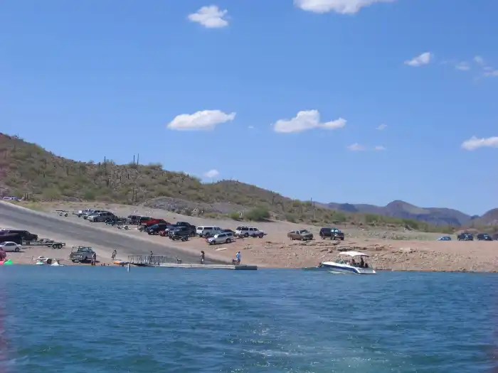
Boat Ramps at Lake Pleasant
Lake Pleasant Regional Park has three public boat ramps. Pleasant Harbor Marina has two public boat ramps and one private boat ramp.
- 10-Lane Boat Ramp (accessed via Park main park entrance)
- 4- Lane Boat Ramp (accessed via Park north entrance)
- Agua Fria Boat Launch (seasonal for small boats only-accessed via main park entrance)
- 4-Lane North Boat Ramp (accessed via Pleasant Harbor Marina entrance)
- 4-Lane South Boat Ramp (accessed via Pleasant Harbor Marina entrance)
Lake Pleasant Boat & Watercraft Rentals
You don’ t have to own a boat to enjoy the water. You can rent a variety of boats and watercraft at the lake. Below are links to help plan a day on the water:
- Boat Rentals at Scorpion Bay
- Jet Ski Rentals
- Boat Rentals at Pleasant Harbor
- Lake Pleasant Siteseeing Cruise
- Kayak & Paddleboard Rentals
- Sailing Lessons
- Sailing & Yacht Training
- Captained Charted Boat Rental
Coves at Lake Pleasant
Lake Pleasant has many coves for a fun day on the boat. With so many coves to explore there you can find a less crowded spot or work your way over to the party cove. For more information about Lake Pleasant coves visit are Lake Pleasant Coves post.
Camping at Lake Pleasant Regional Park
There are several hiking trails located around Lake Pleasant as well as areas to camp. There are two campgrounds at Lake Pleasant Regional Park. Both are desert setting campgrounds, saguaros and various desert scrub brush. Camp sites are available as developed, semi developed, and undeveloped camp sites.
Desert Tortoise Campground
The Desert Tortoise Campground is located just before the 10-lane boat ramp and has short walking distances to the water. This campground has restrooms, showers and RV dump station. Ramadas offer shade at each site.
Roadrunner Campground
The Roadrunner Campground is just before the Discovery Center and offers restrooms, showers and a playground, but is a little further walk to the water. All camp sites are considered developed in the Roadrunner campground with water and electrical hookups.
There is also a RV Resort available at Pleasant Harbor Marina.
Wildlife at Lake Pleasant
We have often seen wild burros and bighorn sheep at Lake Pleasant. Once we saw a mountain lion which was pretty cool because we were in a boat and not hiking.
There is a pretty good chance you’ll see burros at Jackass Cove and once the sun goes down and most of the people have left you will see them everywhere. It’s actually my favorite time of day at the lake.

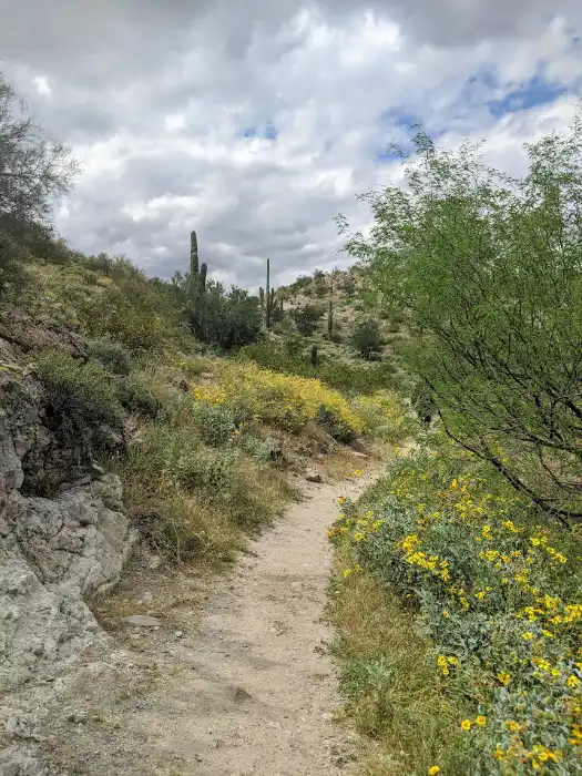
Hiking at Lake Pleasant
The hiking trails have some nice views of the dark blue water against the desert backdrop. There are three main hiking trails that can be accessed from the main entrance of the park.
- Pipeline Canyon Trail
- Roadrunner Trail
- Visitor Center Trail
Pipeline Canyon Trail
At 2 miles Pipeline Canyon Trail is the longest trail with wonderful views of the western lake shoreline. The trail can be accessed from the North entry right off of Cottonwood Lane.

Roadrunner and Visitor Center Trail
The Roadrunner trail and the Visitor Center Trail are both accessed from the Visitor Center parking lot. The Roadrunner trail at 1.5 miles is is a desert hike that overlooks the water. The Visitor Center trail is a short 1/2 mile interpretative desert hike.
The Visitor’s center has some information on the lake and the desert. You also have some nice views of the Waddell Dam and the surrounding lake.
Fee: Yes
Address: 41835 N. Castle Hot Springs Rd
Phone: 602-372-7460
For more information visit: Lake Pleasant Regional Park