
Hike in One of The Largest City Parks: South Mountain Park
Nestled right in the middle of Phoenix, South Mountain Park and Preserve is one of the largest municipal parks in the world. Over 50 miles of trails, city and mountain views, and plenty of historic charm packed into this outdoor playground.
Take a leisurely drive to the top or South Mountain park or lace up and hike on one of the many trails. At 2,330 feet in elevation, Dobbins Lookout is the highest elevation accessible by trail.
So, are you up for a little adventure? Let’s hit the road!
This post may contain affiliate links. Please read my disclosure policy.
Explore South Mountain Park
Scorpion Gulch
Before you wind your way up the mountain, make a quick pit stop at Scorpion Gulch. Trust me, it’s worth the pause. This quirky little spot feels like stepping back into the 1930s.
Once a trading post and later a bar, the stone walls and open-air ruins of Scorpion Gulch are interesting to walk around in. You’ll find it right at the base of South Mountain, so it’s super easy to access.
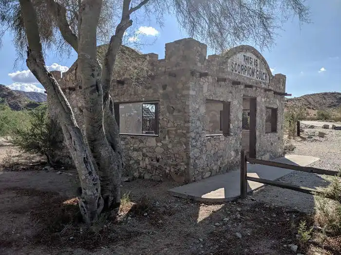
Wander around, snap a few photos, and imagine what life must’ve been like when folks gathered here for supplies or a cold drink after a dusty day in the desert.
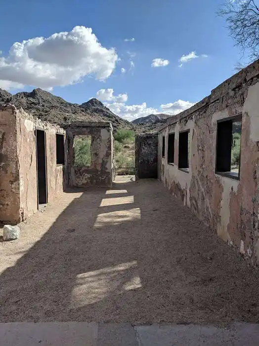
Fun fact: Scorpion Gulch is on the Phoenix Historic Property Register, so it’s officially a piece of the city’s story.
Driving in South Mountain Park
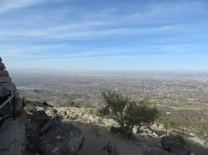
Buckle up and follow Summit Road for a 5.5-mile scenic drive to the top. Along the way, there are several pullouts—perfect for stopping and soaking in those panoramic views of Phoenix sprawling out below like a giant map.

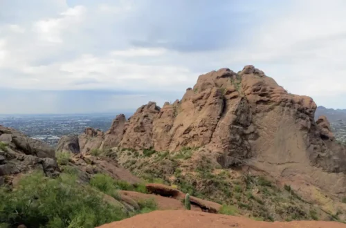
South Mountain Dobbins Lookout
At Dobbins Lookout, you’ll hit 2,330 feet in elevation, the highest point in the park you can reach by car. There’s an old observation tower here, built from stone.
This is a prime picnic spot, too. So if you packed snacks or a sandwich, go ahead—find a rock, spread out, and enjoy the scene.
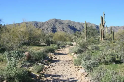
Hike Fat Man’s Pass at South Mountain Park
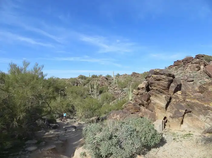
South Mountain has over 20 trails—from easy strolls to leg-burner hikes.
One of the best is the National Trail. This one’s a favorite because you can see rock formations, city views, and hidden spots like Fat Man’s Pass. From this trail you can view the ridgeline, as well as the interior of south mountain.
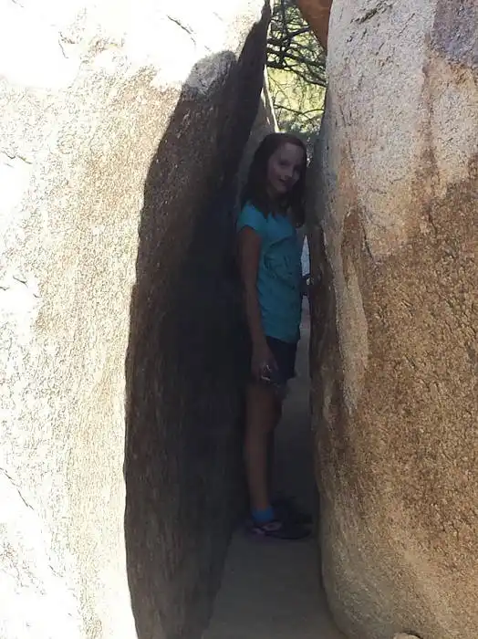
Fat Man’s Pass is located on the National Trail. To hike this popular section of the trail drive to the top of the mountain at Buena Vista lookout. There is very limited parking. The earlier you arrive the better or you may have to wait for parking.
Hidden Valley trail is right off the parking lot. Follow this trail for a mile and a half until you reach a sign that points to Hidden Valley. Turn left, walk a little further and Fat Man’s Pass will by on your right.
Now, here’s the fun part: you can either squeeze through the giant, smooth granite boulders—just like a kid playing hide-and-seek—or walk around the rocks if you’re not in the mood for tight spaces.
Location: 10919 S. Central Ave. Phoenix, AZ